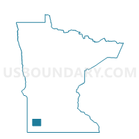
Fulda Voting District, Murray County, Minnesota
About
Outline

Summary
| Unique Area Identifier | 603264 |
| Name | Fulda Voting District |
| County | Murray County |
| State | Minnesota |
| Area (square miles) | 1.11 |
| Land Area (square miles) | 1.03 |
| Water Area (square miles) | 0.08 |
| % of Land Area | 92.88 |
| % of Water Area | 7.12 |
| Latitude of the Internal Point | 43.86756010 |
| Longtitude of the Internal Point | -95.60571290 |
Maps

Graphs
Select a template below for downloading or customizing gragh for Fulda Voting District, Murray County, Minnesota